


MTTM. Flood. 2. Territorial redevelopment
2.5. Creation of buffer strips
MTTM-FLO-2.5
Description
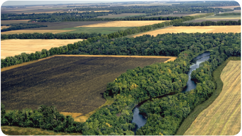
Buffer strips are vegetated or undeveloped strips strategically located between potential water sources (such as rivers and lakes) and developed areas (cities, farmland). They act as a natural barrier, helping to manage stormwater and prevent flooding. Their implementation helps reduce the risk of flooding and erosion, thereby protecting infrastructure and farmland. The soil and plants in buffer strips capture and filter pollutants (sediment, chemicals, nutrients) from stormwater before it reaches water bodies. The implementation process includes:
Site Selection: Identifying critical areas where buffer strips are needed, such as along rivers, lakes, or between farmland and urban areas. Buffer strips can be created in parks, along roads, or in separation zones between infrastructure and water bodies.
Vegetation Types: Selection of appropriate plants (grasses, shrubs, trees) that are effective at filtering pollutants and resilient to local conditions.
Dimensions and Configuration: Determining the width and structure of the buffer strip based on topography and land use to maximize efficiency.
Buffer strips can be created in parks, along roads, or in areas separating infrastructure from water bodies.
Advantages
Buffer strips reduce the velocity of surface water, allowing it to infiltrate the ground and reducing the risk of flooding in surrounding areas. Buffer strips infiltrate stormwater into the soil, helping to recharge aquifers and maintain groundwater levels, while also stabilizing riverbanks and other waterways, preventing erosion and reducing sediment transport. Buffer strips also provide habitat for a wide range of plants and animals, contributing to local biodiversity.
Disadvantages, critical issues, and the need for additional measures
Creating buffer zones may require setting aside areas from agricultural use or urban development, which can lead to land-use conflicts. In extreme rainfall events, the buffer zones’ capacity to store and infiltrate water may be exceeded, requiring additional measures to manage large volumes of water, such as detention basins.
Assessment against the criteria
Applicability and impact
Efficacy
Applicability
Environmental sustainability
Reversibility
Formal and constructive impact
Quality of urban redevelopment
SDGs number
Durability
***
**
*****
***
***
****
4
***
Cost and construction logistics
Monetary cost
Construction complexity
Availability (time)
Execution time
Maintenance costs
Regionality
Use restriction
**
**
****
***
****
***
****
Production process
Degree of innovation
Sustainability
***
*****
Relationship with the indicators of the Risk Analysis Model
Regional hazard: Regional hydrographic conditions.
Riferimenti
xxx