


MTTM. Flood. 2. Territorial redevelopment
2.3. Lamination + infiltration basins
MTTM-FLO-2.3
Description
Lamination basin
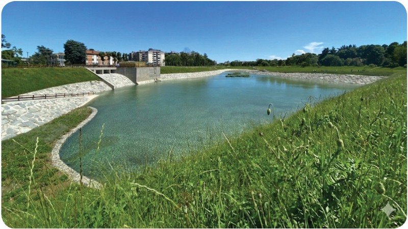
A lamination basin is a structure designed to manage large volumes of stormwater during heavy rainfall events. Its primary function is to temporarily store excess water and regulate its flow into drainage systems or natural waterways, preventing sudden spikes in flow that could cause flooding downstream. The lamination basin allows for a controlled and gradual release of the accumulated water, “smoothing out” the flow and distributing it over time. This structure is particularly useful in areas where large impervious surfaces, such as roads and parking lots, can generate significant volumes of runoff during rainfall. Lamination basins can be designed as dry basins, which remain empty under normal conditions, or as permanent basins, with a minimum water level maintained year-round.
Infiltration Basin
An infiltration basin is a structure that facilitates the natural infiltration of water into the soil, helping to recharge aquifers and reduce surface runoff. Composed of permeable materials, such as gravel and sand, the infiltration basin allows rainwater to percolate through the soil layers and infiltrate into the subsoil. This structure is designed to retain water for a sufficient period of time to allow for its natural absorption into the soil. It is particularly effective in areas with highly permeable soils, where water can infiltrate quickly, reducing the risk of ponding or flooding. Infiltration basins are commonly used in both urban and rural settings, where groundwater recharge and runoff reduction are key priorities.
Relationship Between a Lamination Basin and an Infiltration Basin
The combination of a lamination basin and an infiltration basin optimize stormwater management both in terms of volume control and groundwater recharge. In this configuration, the lamination basin serves as the primary temporary storage structure, collecting and retaining large quantities of water during heavy rainfall events. Thanks to gradual release, the water flow is distributed over time, preventing an immediate overload of the infiltration basin.
Once the water has been regulated and the flow is under control, the infiltration basin receives the regulated water from the lamination basin, allowing for slow, natural percolation into the ground. This combined process ensures that water is managed safely and sustainably, preventing soil erosion and saturation while improving the quality of the water that reaches the aquifers. The integrated use of the two structures minimizes surface runoff while protecting surrounding areas from potential flooding and increasing the resilience of the local water system.
Advantages
The lamination basin’s ability to distribute water flow over time significantly reduces the risk of downstream flooding and protects surrounding urban and rural areas.
The infiltration basin facilitates water absorption into the soil, contributing to the recharge of groundwater resources and supporting sustainable use of aquifers.
The combination of the two basins reduces the volume of water flowing into drainage systems, easing the load on existing infrastructure.
Natural water infiltration promotes the removal of pollutants and supports soil biodiversity, improving overall water quality
Disadvantages, critical issues, and the need for additional measures
This combination is most effective in areas with permeable soils; in areas with clayey or compacted soils, the system’s effectiveness may be limited and may require additional measures to improve permeability.
The implementation of both basins requires sufficient space, a requirement that can be difficult to meet in high-density urban areas or in confined spaces.
Assessment against the criteria
Applicability and impact
Efficacy
Applicability
Environmental sustainability
Reversibility
Formal and constructive impact
Quality of urban redevelopment
SDGs number
Durability
*****
**
****
**
***
***
4
****
Cost and construction logistics
Monetary cost
Construction complexity
Availability (time)
Execution time
Maintenance costs
Regionality
Use restriction
*
*
***
****
****
***
***
Production process
Degree of innovation
Sustainability
***
****
Relationship with the indicators of the Risk Analysis Model
Regional hazard: Regional hydrographic conditions
References
xxx