Analysis and projections of salt intrusion in the Livenza River to develop effective adaptive management strategies
The salt intrusion modeling project along the Livenza River, commissioned by VERITAS to CORILA, in collaboration with several institutes of the National Research Council (ISMAR, IGG, ISP), has been concluded. The work represented an important advance in the understanding of the hydrodynamic dynamics that regulate the extension and persistence of the salt wedge in the terminal stretch of the river. The project was launched following the water emergency of summer 2022, when the rise of the salt wedge along the Livenza, accentuated by the drought, put at risk the withdrawal for drinking water use at the Veritas plant in Boccafossa, which also serves the tourist users of Caorle and Eraclea.
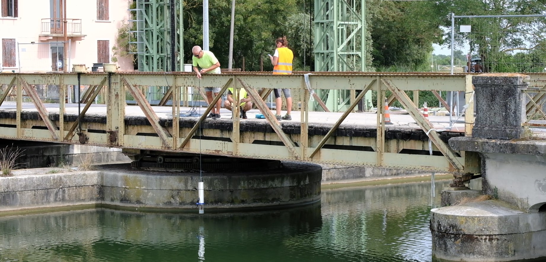
Intensive field survey work was carried out as a preparatory step for the modelling activities, which was essential for calibrating the hydrodynamic model and correctly interpreting the observation dynamics. The surveys extended to the Livenza mouth system, consisting of the main riverbed and the Riello and Commessera canals, involved measuring salinity along the entire water column, in different flow and tide conditions, and allowed us to investigate the flow distribution, highlighting the strong variability of the phenomenon and the importance of continuous monitoring. Although it was not possible to carry out measurements in dry weather, as the year 2024 was characterized by prolonged and intense rainy periods, the results of the surveys are useful for defining the general hydrological framework in spring tide and base flow conditions, useful for the analysis and modelling of the river system in critical conditions.
The core of the study was the use of the three-dimensional model SHYFEM, which allowed us to simulate in detail the response of the river system in different hydrological and marine conditions. The simulations showed that salt intrusion occurs significantly in the presence of river flows lower than 30 m³/s, but also that the combined effect of reduced flow and sea level rise, particularly in storm conditions, is capable of pushing brackish water up to several kilometers inland, well beyond the usual thresholds.

Maximum extension of salt intrusion with a flow rate of 40 m³/s and conductivity measured at 1.5 m from the water surface. The highlighted area is occasionally affected by water with salinity higher than 0.4 psu (about 800 µS/cm).
Persistence maps indicate which buffer areas may occasionally be affected by bottom salinities higher than 0.4 psu (about 800 µS/cm) and which, instead, experience this condition for prolonged periods. This information, although not critical for drinking water supply, is particularly relevant for agricultural uses. Furthermore, a persistence higher than 50% indicates areas regularly influenced by tidal oscillation, delineating the dynamic boundary between fluvial and marine influence.
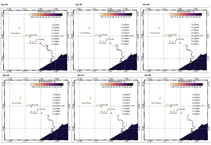
Maps of percentage persistence of salinity values higher than 0.4 psu (800 µS/cm) for the six simulations that impose a flow rate between 30 m³/s (top left) and 80 m³/s (bottom right). All assume summer configuration with diversion in Albano at -23.3 m³/s, maximum tide height at sea 50 cm, msl = 0 cm.
Furthermore, the Livenza river and coastal system is subject to increasing vulnerability, due not only to hydrological and tidal dynamics, but also to long-term geophysical factors: subsidence, estimated at about 0.5 cm per year, and mean sea level rise due to eustasy, in the order of 0.3 cm per year, intensify the risk of salt intrusion. Modelling suggests that, under future conditions of sea level rise, intrusion could become more frequent and intense even without significant variations in mean river flows. For these reasons, the working group recommends maintaining continuous and targeted monitoring of flows and salinity, extending it to the main diversions and along the entire water column, and developing integrated, flexible and shared management strategies, to protect the balance between fresh and brackish water.
The results of the project, the result of intense multidisciplinary work and collaboration between research institutions and managers, offer a solid knowledge base to address the risk of salt intrusion in the Livenza. This study is part of the activities of the scientific community of the European research infrastructure DANUBIUS-RI, the International Centre for Advanced Studies on River-Sea Systems, which offers access to observation platforms, laboratories and cutting-edge modelling tools. The methodologies and tools developed within the supersite “Po Delta and Northern Adriatic Lagoons” are also applicable to other similar territorial contexts and river sites, contributing to a more effective management of salt intrusion risk on a larger scale.
The simulations carried out within the project also offer a valuable operational tool to support future decisions on water management, soil protection and adaptation to climate change.
The study was presented yesterday, 27 May 2025, during the final meeting held at the Municipality of Caorle. During the event, the results achieved and the prospects for future development were discussed. The work will continue with the aim of constantly updating the morphological and hydrological data of the system, further improving the model calibration and evaluating long-term scenarios related to climate, the diversion regime and coastal dynamics.